Most map collections are typically flush with historic and contemporary physical and political maps of their region. However, a deficit commonly exists for original historic maps published throughout the rest of the world. This is where the acquisition of reproductions, facsimiles and realia of historically significant cartographic items comes into play.
Over the last 25 years with increasing scanner sizes, exponential bandwidths, and colossal servers it has become commonplace to discover and download one of the most nonuniform of print formats, the map. An infinite spatial collage can now be found online through a wide variety of platforms ranging from national, regional libraries, and archives, to the toppermost of the poppermost1 and extremely well financed Davis Rumsey Map Collection.
The William C. Wonders Map Collection began long before the Internet. The collection started in the geography department during the 1950s.2 At this time (up to the 2000’s) map reproductions were distributed through various analogue sources. This included calendars,3 NMC (National Map Collection) reproductions,4 the Association of Canadian Map Libraries and Archives Historical Maps Series, the Historic Urban Plans series of reprints of cities worldwide. During the 1960s many atlas facsimiles were acquired through an Amsterdam publishing house Theatrum Orbis Terrarum.5 In more recent times the map collection has acquired two additional, detailed and highly consulted reproductions. These are the Erdapfel (Earth Apple) Globe, originally published in 1492, and the Hereford Mappa Mundi produced in c. 1300.
Erdapfel (Earth Apple) Globe
This realia reproduction of the 1492 Erdapfel (Earth Apple) globe6 by Martin Behaim has become a go-to teaching aid during map collection engagement activities. We welcome students to touch, turn and examine the globe closely. Then we inquire “what is missing?” After a pause, and often a hint, classes notice that the Americas are absent. The globe was in production as Columbus set sail. The Earth Apple also serves as a spatial golden spike, for those who lean toward the Columbia Exchange as the beginning of the Anthropocene.7 Representing a Eurocentric world on the doorstep of colonizing vast swaths of the earth.
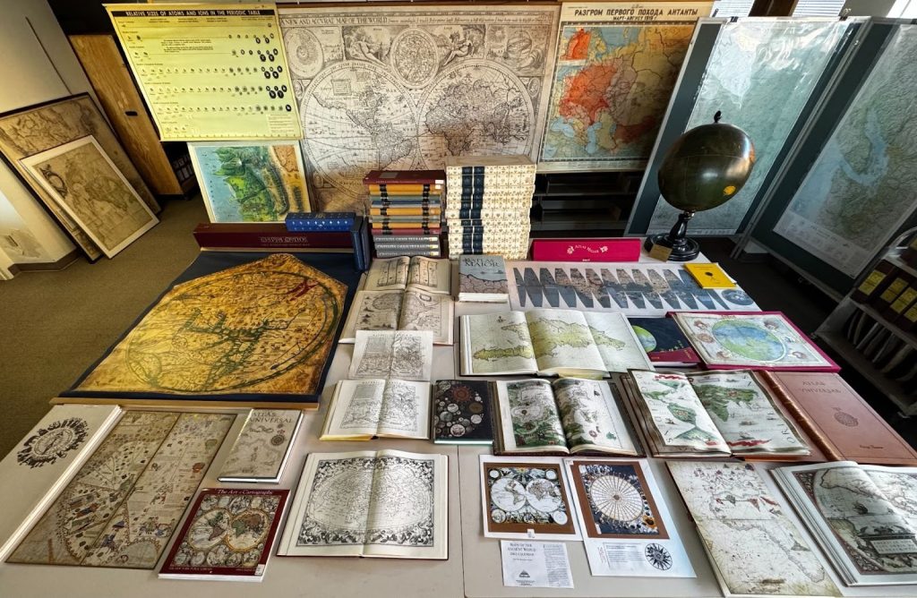
Figure 1. A small selection of William C. Wonders Map Collection facsimiles. Check out the following link for a list of the items displayed.
Hereford Mappa Mundi
This particular reproduction has over 100 kilometers of travel under its T in O8 belt. Serving as the center piece for many high school outreach spatial literacy presentations. It is also a must see for tours, and workshops. Classes and individuals spend time trying to re-orient themselves in this unfamiliar medieval vision of the world that places East at the top of the map(pa). If individuals want to investigate further, the Hereford Mappa Mundi includes two informative volumes that expand upon the details of every symbol, place and mythological figure.
If you are interested in interacting with any of the reproductions mentioned above or think they may be useful in your liaison areas please reach out to us at data@ualberta.ca
- A motivational phrase used by The Beatles during their early days (1960-62) playing in Hamburg. ↩︎
- In 1953 William C. Wonders (Department of Political Economy) taught two courses under the banner of Geography. Physical Geography and Human Geography [University of Alberta Calendar 1953-1954]. By 1955-1956 four more courses were added. Economic Geography, Cartography, Anglo-America and Northern Lands. [University of Alberta Calendar 1955-1956] ↩︎
- The results of a search for “calendar” in the William C. Wonders Map Collection database. ↩︎
- Map laid down from the sketches and observations of Mr. Peter Fidler for J. G. McTavish Esquire by G. Taylor Junior; 1827. NMC 00213354 [Internet Archive] ↩︎
- Theatrum orbis terrarum corpus of old atlases in facsimile. (1974). Theatrum Orbis Terrarum Ltd. [Internet Archive] ↩︎
- The earth apple is available virtually through the David Rumsey Map Collection. As a 3D globe, and as a series of flat globe gores, which can be cut out and pasted on a sphere. [Online] ↩︎
- Davis, H., & Todd, Z. (2017). On the Importance of a Date, or, Decolonizing the Anthropocene. ACME: An International Journal for Critical Geographies, 1(4), 761-780. [Article] ↩︎
- Clemens, Raymond. (2022). Medieval World Maps (T-O Maps). [Online] ↩︎