Submission 2024
| Submitted by: | Ryusuke Kimitsuki |
| Department: | Earth and Atmospheric Sciences |
| Faculty: | Science |
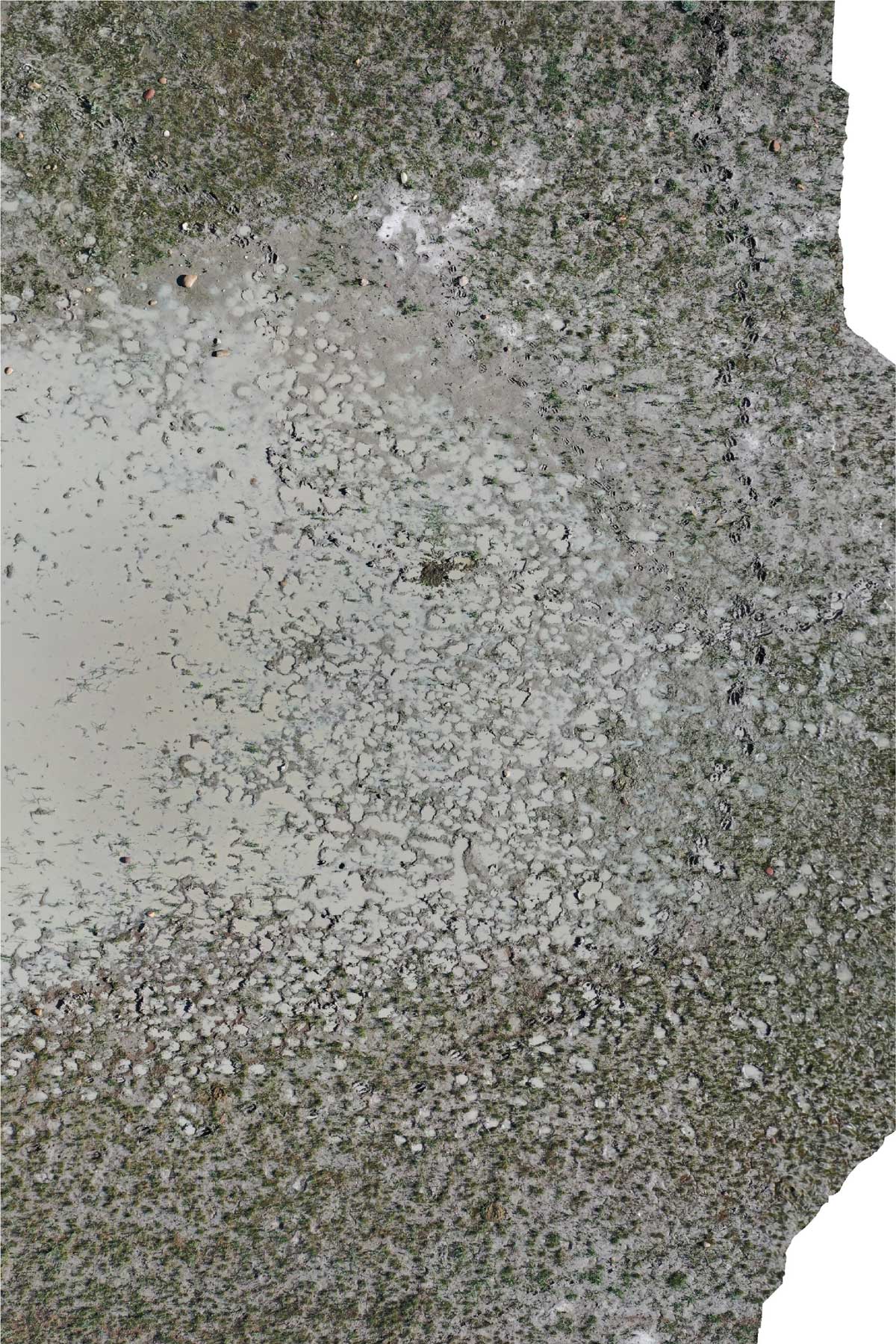
Ichnology is the study of trace fossils. While we normally work on fossil materials of animal tracks, burrows, coprolites…etc., we also study structures produced by modern animals (Neoichnology) to better interpret the fossil materials and the depositional environments. This picture is an orthomosaic image of animal trackways that occur around an ephemeral lake in Cypress County of Southern Alberta. Multiple aerial images were taken using a drone and compiled to produce a 3D model of the land scape. The model is then used to analyze the distribution of animal traces in relation to the lake waters. 3D modelling is an important tool in ichnology as we can make precise measurements of vast landscapes and tall cliffs in the lab, rotate heavy or fragile materials with ease, and highlight small structures that can easily be missed in the fields. Most of the tracks and trackways in this image are made by cattle from the pasture, but you can also find smaller trackways produced by elks and pronghorns. During the field study, tracks of ground squirrels, coyote, and shorebirds, ground squirrel burrows, spider burrows, clam shrimp trails, and ant hills were also found.
Was your image created using Generative AI?
No.
How was your image created?
This is an orthomosaic image based on a 3D model generated using Agisoft Metashape Professional version 1.6.5. The model consists of 145 aerial images taken using DJI MAVIC 2 drone. The original model is much larger in scale which makes the animal tracks too small to be seen in full view, hence the image had been cropped and fitted to the canvas size, so that the details are visible to the viewers.